HAWAIʻI ISLAND PROPERTY REFERENCE
Find your way around
a Tax Map Key.
Use the map to understand the district and section behind a Hawaiʻi Island property’s TMK.
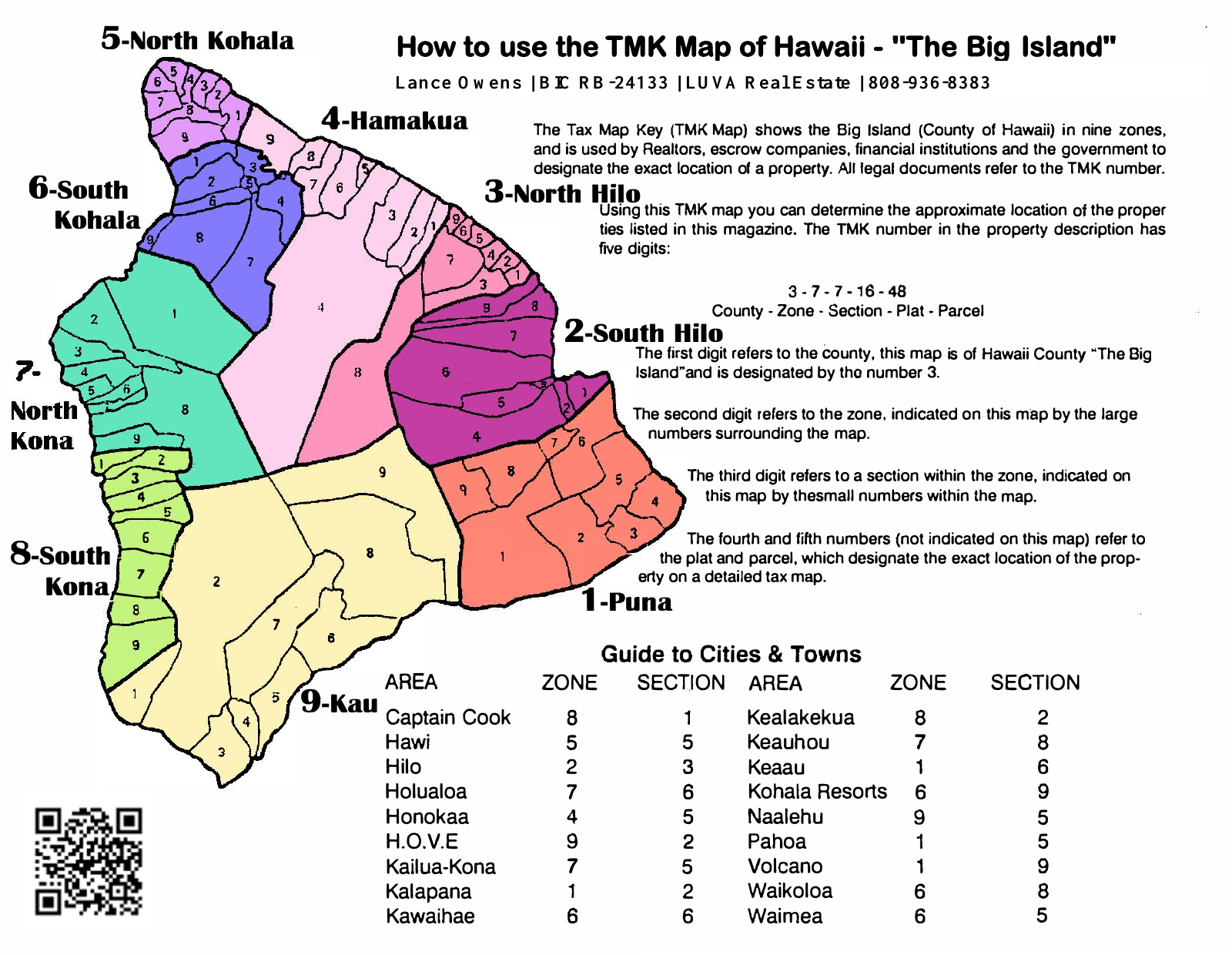
Read the parts in order.
The map uses the example 3-7-7-16-48: Hawaiʻi County, zone, section, plat, and parcel. The leading 3 identifies Hawaiʻi Island. The next number identifies the district shown on this map.
For example, zone 7 is North Kona and zone 8 is South Kona. The next number narrows the location to a section within that zone.
This is an orientation map, rather than a survey or a determination of a property’s legal boundaries. The map content is retained from our prior website; Lance’s broker license information has been updated.
Tell us which areas interest you ↗| Zone | District |
|---|---|
| 1 | Puna |
| 2 | South Hilo |
| 3 | North Hilo |
| 4 | Hāmākua |
| 5 | North Kohala |
| 6 | South Kohala |
| 7 | North Kona |
| 8 | South Kona |
| 9 | Kaʻū |